Belknap Range Trail Tenders

Calendar
Get Involved
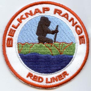
Redlining Patch
Contact
The Belknap Range features a wide variety of trails. Inspired by the White Mountain Redlining challenge, the BRATTS have created a patch for hiking all of the sanctioned trails around the range - some 70.5 miles! The goal is to have fun while exploring all the range has to offer. Perhaps you'll be inspired to join the BRATTS in helping to maintain some of these trails!
The Belknap Range Redlining Workbook features a list of all of the current trails. Any new trails will be added to the list at the beginning of each year. Unexpected trail closures will be removed from the list as known.
All trails must be hiked in their entirety using one's own feet, whether hiking, trail running, snowshoeing, and/or skiing. Please note that trails are located on state, county, town, and private property. Please abide by all signs and procedures, such as check in procedures when hiking in scout reservations.
A 2.5 inch iron-on Belknap Range Redliner patch can be obtained for a $10 (or more) donation to the Belknap Range Trail Tenders (a 501(c)3 non-profit organization). Instructions are included in the Redlining Patch Application below.
Most of the trails are depicted on the BelknapRangeTrails.org and/or AMC Southern New Hampshire Guide 4th Edition maps. Some additional peaks, such as Locke's Hill and Pine Mountain, have maps at their trailheads. Every trail is represented on NewEnglandTrailConditions.com's Belknap Range page.
Resources
Finishers